Stage 2 Part Two - Navigation and Cross Countries
In this phase of my training, I was focusing on the things you’ll do when you’re a “real pilot”. While a huge part of the thrill for me is learning the basic “stick and rudder” skills that are foundational to flying, ultimately, you fly so you can go places. The idea of waking up one morning and deciding to fly to the San Juan Islands, to Portland, or to the Olympic peninsula sounds pretty special. This post contains more pictures than usual, since I actually went somewhere! Read on.
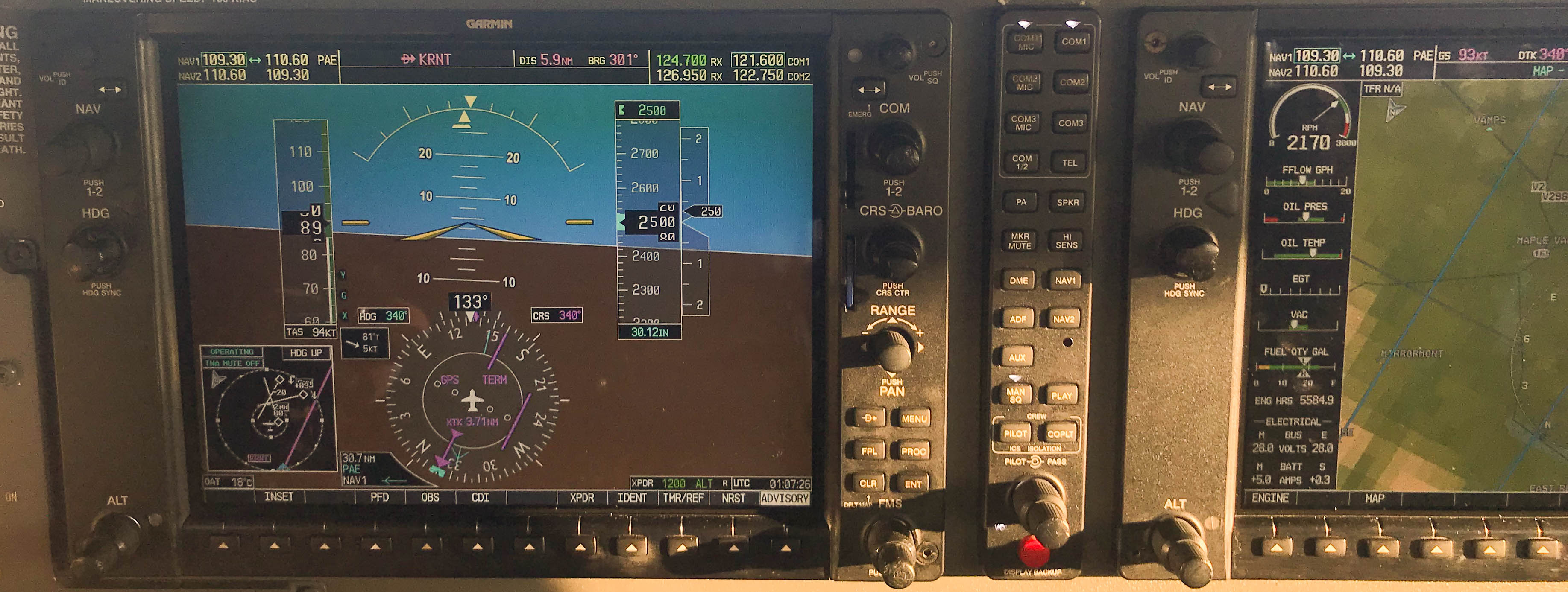
My first flight on navigation was in the simulator. There are a number of tools available to me in the modern airplane (using Garmin’s G1000 avionics), and controlling those tools is complex. It’s better to learn some of them on the ground rather than in the air. It’s pretty cool - the computer in the airplane enables me to dial in a flight plan using GPS waypoints, and then help make sure I get those points. Another tool is a VOR radio. It’s an esoteric navigation system that I’ll need to use from time to time. I learned how to use that too. To be clear, by “learned”, I really mean “was introduced to”. The G1000 has a number of buttons on it. The picture below is a crop of the one I used in last week’s post, and you can’t see the far right side of the MFD which has another row of buttons (the right panel is called the Multi-function Display, because you use it for navigation and engine instruments). Not only do you have to learn all those buttons, they each have their special magical incantation. The FMS knob is a great example. It has two separate twisty bits, and you can also push it in. What the twists and pushes do changes depending on what you’re trying to accomplish. I start to get good at it, then I don’t do that function for a while, and then I’m useless again.
My second flight was actually going up in the airplane and doing it. Now I was pushing a bunch of G1000 buttons that I hadn’t before. I also did much of this lesson under the hood - using that view limiting device I’ve described before. The only thing you can see is the instruments. The intent is to give you lots of time where you’re only using instruments to fly, in the case where you fly into bad weather and can’t see very well outside. This flight was super fun, as Troy acted like an air traffic controller, and I was the pilot. “Turn left heading 265 and climb 6000”. “Roger, turning left heading 265, climbing 6000”. I felt like a real pilot.
As an aside, I have an app called “LiveATC”. This app lets you tune into ATC at many different airports all across the world. I got it initially so I could learn the rhythm and speech patterns that are used in the air. It was helpful for my own radio calls, but I found that I simply liked listening to it. Sometimes, I’m in the car heading to the airport, I tune it in to get a sense of what’s happening. I also like to listen to it when I’m on a commercial flight. I listen to the tower talking to the airplane I’m on, and it’s cool when I can tell there is going to be a delay before they tell the passengers. One time, I was listening to the ground station for an airport I was departing from (I forget which one), and the ramp operators were using that channel, which I think is a no-no. They were going back and forth because a customer had gate checked a stroller, but left an iPad in the stroller. They were using the frequency to figure out how to get the iPad to the customer before the airplane pushed from the gate. It was pretty funny - they were not speaking of the customer in a particularly friendly way.
Anyway, back to that second navigation flight. Flying with the view limiting device is all about “keeping up a scan”. There are six instruments that you use to tell you how the airplane is flying: attitude indicator, airspeed, magnetic direction, turn coordinator, altimeter, and vertical speed indicator. You have to look at all of them all the time to make sure the airplane is doing what you want. I had read a little about this, so doing it for real was pretty fun. That second flight ended well, with Troy giving me kudos on positive aircraft control. He said that I was able to keep up with all the directives he was giving me, which many student pilots can’t. That was good to hear.
This was all leading up to our first cross country flight, which Troy and I would fly together. A cross country is not actually a coast to coast flight, which in a Cessna 172 would probably take a couple days. It’s a flight where you take off from one airport and land at another. To qualify as a cross-country, the second airport needs to be at least 50NM away. I suggested, and Troy agreed, to fly to Hoquiam, a small non-towered airport on the Pacific coast. Troy put a little twist on it though. He wanted me to plan the flight by hand, not using the GPS in the plane. This meant taking out a chart, using a plotter and a mechanical flight computer and creating a navigation log, or “navlog”. While in the air, I would use this log, a compass, and a stopwatch as my only tools to get from Renton to Hoquiam, a distance of 91NM. It’s an old school way to fly. It’s how Charles Lindbergh flew from New York to Paris in 1927, except he was flying over thousands of miles of ocean. I have a whole new level of respect for what early aviators did.
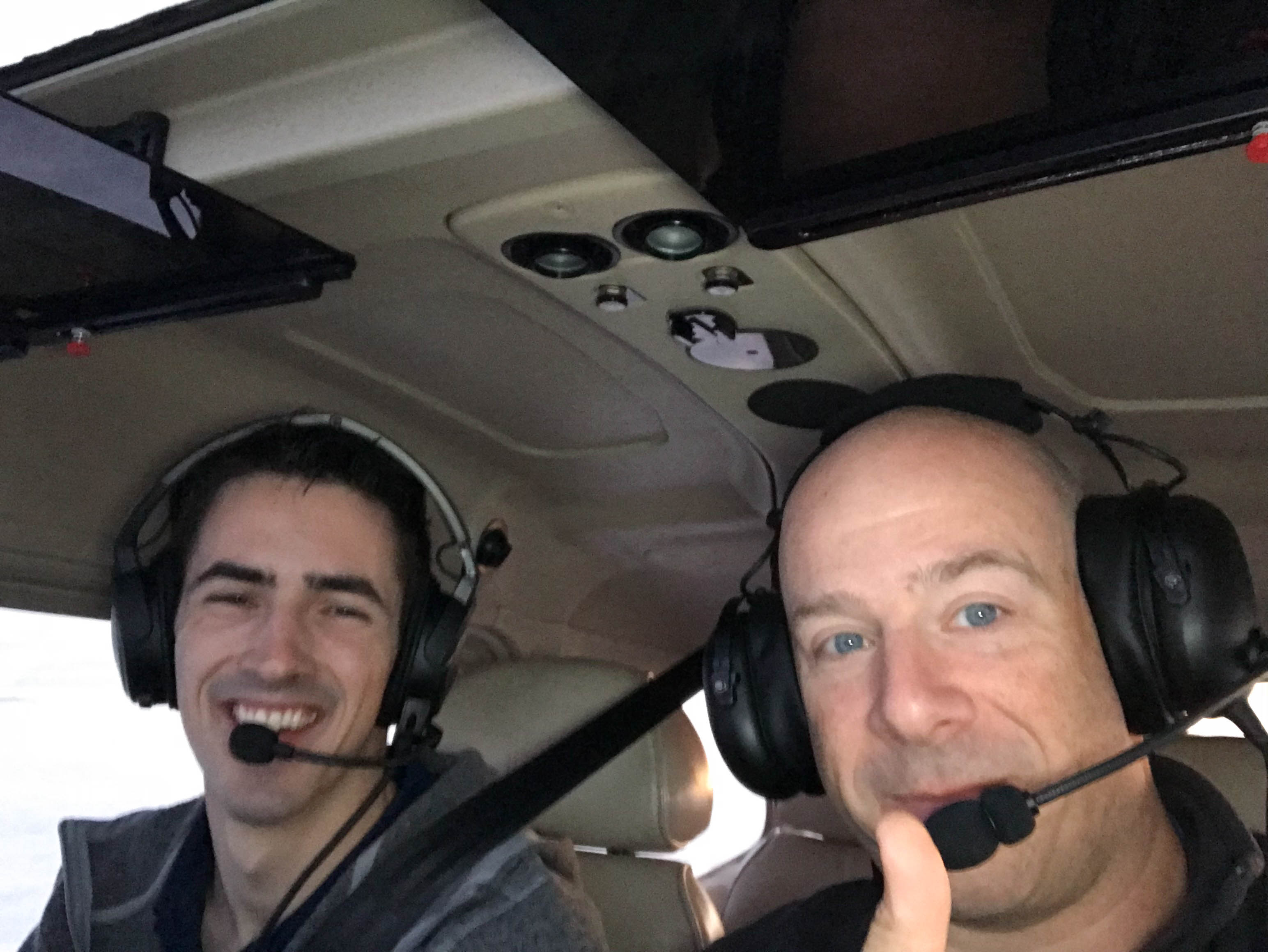
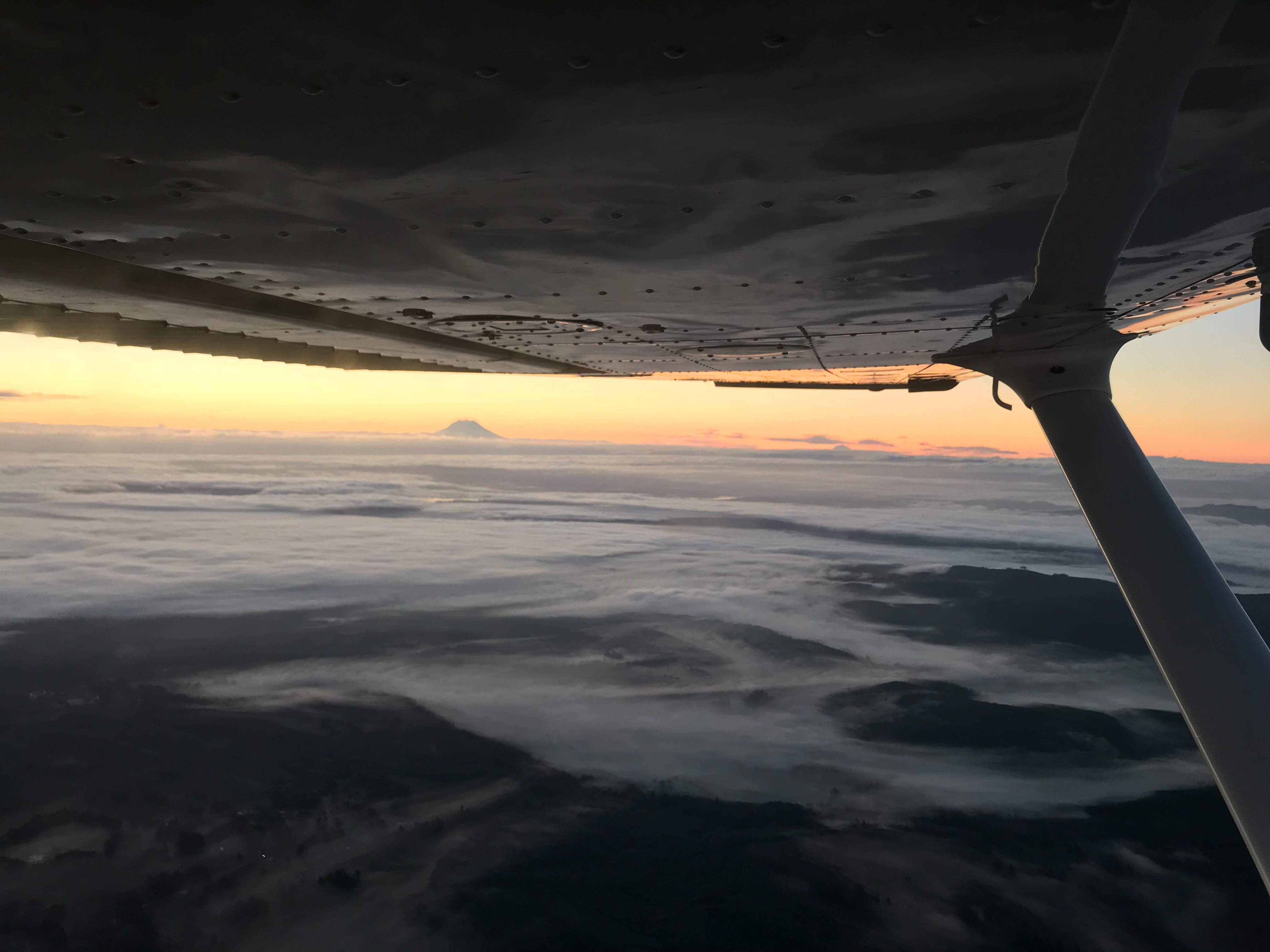
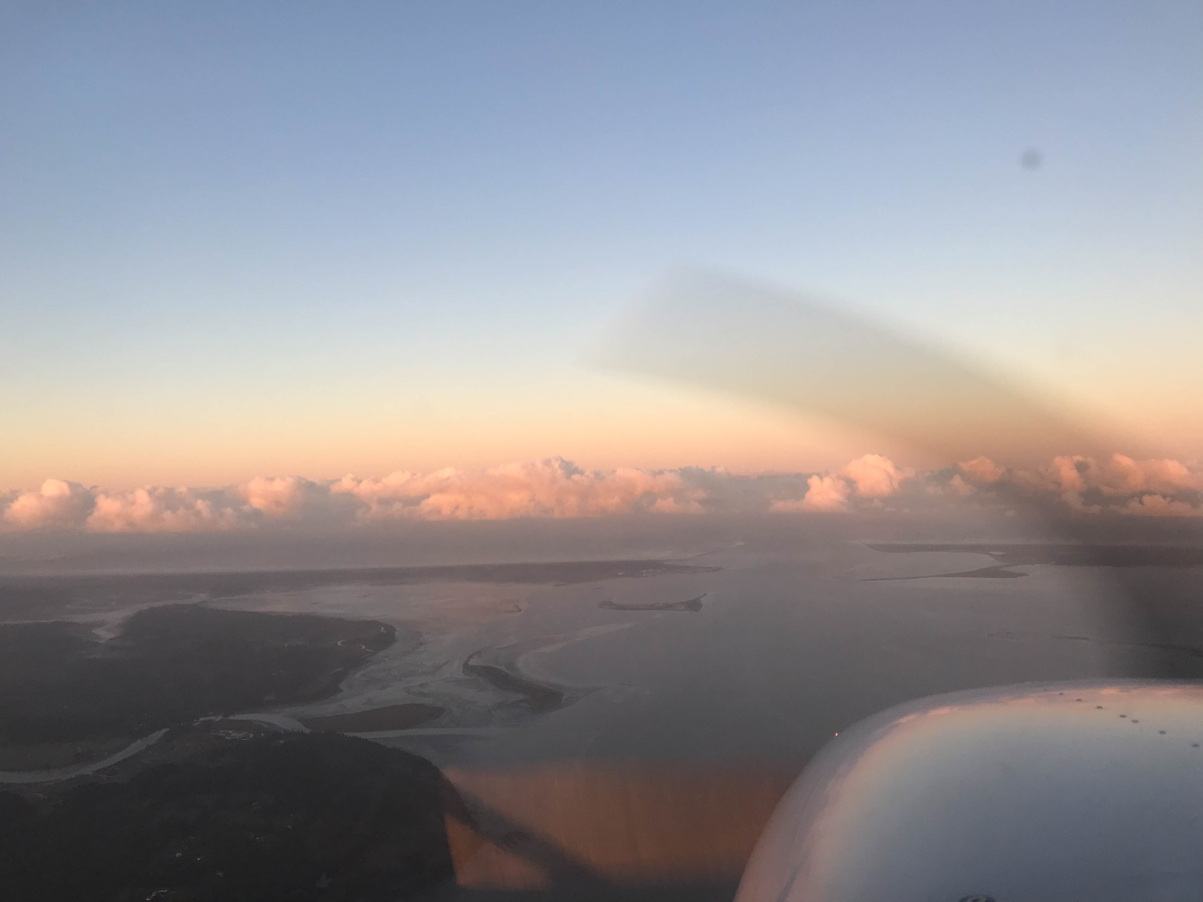
Because airplane rental slots are tough to come by (and my instructor is a cool guy), we agreed to meet at the airport at 6am on a Sunday morning. We took off at 6:30. Our route took us south to Tacoma, then a westward turn over the Puget Sound, then we’d skirt the south side of the Olympic mountains all the way to Hoquiam. I got to see the sunrise behind Mount Rainier, which didn’t suck. Before I knew it, I was over a river that led straight out to the ocean. The scenery all along the route was stunningly beautiful, and this current view was no exception. Off our right wing was the airport. “Troy, there’s the airport, but let’s fly out to the Pacific, and see the beaches.” Troy agreed, and we kept heading west. As we approached the beaches, it became apparent that the solid wall of clouds we saw ahead of us were closer than they appeared. We wound up only going a little bit over the ocean before having to turn around and put it on the ground at Hoquiam. We then headed back to Renton, using the same simple tools as on the outbound.
It was both harder and easier than I expected. Harder, because from the air, waypoints are hard to pick out. While some of the waypoints I chose were larger airports or significant geographic features, others were tiny. We had picked out a small airport about 20 miles east of Hoquiam, and never saw it. But, the easy part of it was that since the planning was solid, and as long as I maintained my headings, speed, and timing, we wound up getting pretty damn close to where I expected to be.
As I’m coming to the end of stage 2, I’m feeling more and more like a pilot. I know how to get to places, I’m getting better at better at controlling the airplane, and I’m more comfortable flying solo. Whereas in stage 1, getting to the end of pilot training seemed impossible, now it feels almost within reach.